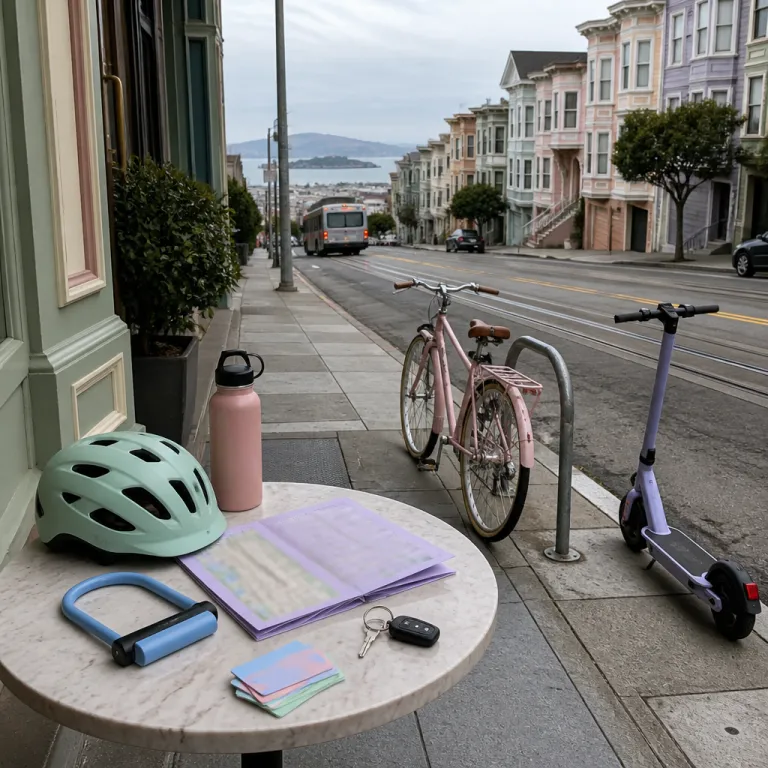
Understanding how to get around San Francisco from your hotel door
Choosing a hotel in San Francisco is easier when you already understand how to get around the city efficiently. On a short stay, your transportation choices shape every day, from the first coffee run to the last cable car ride back toward the Bay skyline. If you plan your routes around the city before booking, you can match your room location to the transportation options that fit your style.
The city public network is dense, so many visitors never need a car, even when they visit several iconic landmarks in one day. Local experts often say, “Is it easy to get around San Francisco without a car? Yes, the city offers extensive public transportation and walkable neighborhoods.” When you understand how to move around San Francisco using Muni buses, Muni Metro, walking, and the famous cable cars, you can confidently choose a hotel without worrying about parking or traffic.
Most central districts around San Francisco hotels, such as Union Square, SoMa, and Fisherman’s Wharf, sit on top of major Muni Metro and bus corridors. This makes it simple to explore city attractions like Chinatown, North Beach, and the Embarcadero in a single day without driving cars through steep streets. When visiting San Francisco for business or leisure, prioritize a location near public transportation stops rather than focusing only on room size or Bay views.
Mastering public transportation for seamless city days
The backbone of San Francisco public mobility is Muni, operated by the San Francisco Municipal Transportation Agency, which runs buses, Muni Metro light rail, streetcars, and the historic cable cars. If you want smooth, stress free travel around the city, learning how to get around San Francisco on Muni before you arrive will save both time and energy. The network covers most neighborhoods you will explore on a typical visit, from the Bay waterfront to the western edge of the city.
A single adult Muni fare is about 2.75 USD at the time of writing (check SFMTA fare pages for current prices, last verified 2024), and the easiest payment method for public transportation is the reloadable Clipper Card used across city public systems. As the official guidance states, “What is the best way to pay for public transportation? The Clipper Card provides convenient access to multiple transit systems.” You can also use the MuniMobile app to buy tickets on your phone, check bus arrival times, and plan transportation options between your hotel and nearby landmarks; day passes and visitor passes on these platforms can be cost effective if you expect to ride several times per day.
Muni Metro trains run underground through downtown San Francisco between stations such as Embarcadero, Montgomery Street, and Powell Street, then surface to serve residential districts, which is ideal when you explore city areas like the Castro or the Inner Sunset. Surface buses and streetcars connect hotels to the waterfront, Golden Gate Park, and other iconic landmarks without needing a car or worrying about parking. When visiting San Francisco for several days, consider staying near a Muni Metro station or a major bus corridor to keep your daily travel simple and predictable, especially during peak commute hours when trains and buses are busiest; aim to travel just before or after the 8–9 a.m. and 5–6 p.m. rush for more comfortable rides.
Riding the famous cable cars and historic streetcars with style
No guide on how to get around San Francisco is complete without the famous cable cars that climb the city’s steep hills. These historic vehicles are both transportation and moving viewpoints over the Bay, linking Union Square, Nob Hill, and Fisherman’s Wharf. When you choose a hotel along a cable car line, you gain a direct and atmospheric way to travel through the San Francisco streets.
The Powell Hyde and Powell Mason cable car routes are especially popular with visitors who want to explore San Francisco neighborhoods while traveling between shopping, dining, and the waterfront. Because cable cars are part of the San Francisco public system, you can pay with the same Clipper Card used on buses and Muni Metro, which keeps your transportation choices simple. For a quieter ride, the F Market and Wharves historic streetcars run along Market Street and the Embarcadero, offering elegant ways around the city with vintage charm; boarding near the line termini early in the day usually means shorter waits, and joining the queue one or two blocks away from the busiest turnarounds can also reduce standing time.
Hotels near Market Street or the waterfront make it easy to explore city highlights using both cable cars and streetcars in a single day. A typical day might start with a cable car from Powell Street to Nob Hill, continue by F line streetcar to the Ferry Building, then end with a sunset ride to Pier 39. When visiting San Francisco with family, this mix of practical public transportation and nostalgic vehicles turns every short transfer into part of the experience; just allow extra time in the afternoon when lines are longest and crowds gather at the turnarounds, especially on weekends and during peak holiday periods.
Balancing car use, parking, and regional travel beyond the city
Many guests still ask whether they should rent a car in San Francisco, especially when planning day trips beyond the city. Within the compact city itself, cars are often slower than public transportation because of traffic, one-way streets, and limited parking. However, if you plan to travel beyond the Bay to Napa, Sonoma, or coastal towns, a car can be useful for flexibility.
For airport transfers, Bay Area Rapid Transit, usually called BART, connects San Francisco International Airport to downtown in about 30 minutes, with a fare around 8.95 USD at the time of writing (confirm current fares on BART’s official site, last checked 2024). This regional train is separate from Muni Metro but works alongside San Francisco public systems to give you more transportation options when you explore San Francisco and nearby cities. Many central hotels sit within a short walk of BART stations such as Powell Street, Montgomery Street, or Embarcadero, which simplifies both arrival and departure days without needing rental cars.
If you still choose a car, confirm hotel parking fees in advance because nightly rates can be high in the San Francisco core, often ranging from 40 to 80 USD, with premium properties sometimes charging more. Some visitors prefer to keep cars only for specific days, using public transportation and cable cars for inner-city travel while reserving driving for regional excursions. When visiting San Francisco for longer stays, this hybrid approach balances cost, convenience, and the desire to explore the wider Bay region; parking apps such as SpotHero or hotel valet advice can help you compare garages, understand time limits, and avoid circling busy blocks.
Enjoying a bike friendly city and walking between iconic landmarks
For travelers who like to move at street level, walking and cycling are elegant ways to experience San Francisco that reveal the city’s character. Many central districts are compact, so you can explore city blocks on foot, moving from cafés to galleries without ever boarding buses. The main challenge is the hilly terrain, which can turn a short walk into a workout in certain parts of the city.
San Francisco has invested in bike lanes and traffic calming, making several corridors genuinely bike friendly for visitors who want to explore at their own pace. Bike share services and hotel concierge desks often provide easy access to a bike for a few hours or a full day, which is ideal for riding along the Bay or through Golden Gate Park. When you plan how to get around San Francisco by bike, focus on routes that avoid the steepest hills and use protected bike lanes wherever possible, and consider e-bikes if you want to reduce effort.
From many hotels near the waterfront, you can explore San Francisco highlights such as Fisherman’s Wharf, the Marina, and Crissy Field almost entirely on foot or by bike. These routes pass several iconic landmarks, including views of the Golden Gate Bridge, without requiring cars or complex transportation choices. When visiting San Francisco with friends, combining walking, bike rides, and short public transportation hops creates flexible ways around the city that feel relaxed rather than rushed; a simple paper or offline map with bike routes marked can make spontaneous detours easier.
Choosing the right neighborhood to explore San Francisco with ease
Where you stay in San Francisco strongly influences how you move around each day. Union Square offers dense city public connections, with Muni, BART, and multiple bus lines converging near major hotels and shopping streets. This area suits visitors who want straightforward ways around the city and quick access to both the airport and the waterfront.
Fisherman’s Wharf places you close to the Bay, the F line streetcars, and the Powell Hyde cable cars, which is ideal if you plan to explore city attractions along the northern waterfront. SoMa and the Financial District provide fast links to Muni Metro, BART, and several San Francisco public bus routes, making them practical bases for business travel and evening dining. When visiting San Francisco for conferences at Moscone Center, staying in SoMa reduces your dependence on cars and keeps most meetings within walking distance.
Neighborhoods like the Castro, Hayes Valley, and the Mission offer a more local feel while still giving you strong transportation options through Muni Metro and buses. From these districts, you can explore San Francisco nightlife, restaurants, and cultural venues, then reach downtown or the waterfront in a short ride. Whatever area you choose, align your hotel with the transportation choices you prefer, whether that means cable cars, bike lanes, or quick public transportation links to the city’s iconic landmarks; a simple mental map of your nearest Muni stops makes day-to-day planning easier, and sketching a one-day itinerary that links two or three nearby neighborhoods can help you explore San Francisco without backtracking.
Key figures on getting around San Francisco
- The standard adult fare on Muni buses, Muni Metro, and most city public services is about 2.75 USD per ride at the time of writing, which keeps daily transportation costs predictable for visitors staying in central hotels (data from the San Francisco Municipal Transportation Agency, 2024).
- The BART fare from San Francisco International Airport to downtown stations is roughly 8.95 USD, offering a cost-effective alternative to cars or ride hailing for airport transfers (data from Bay Area Rapid Transit, 2024).
- San Francisco covers about 125 square kilometres, which makes it compact enough that many iconic landmarks can be reached by a combination of walking, public transportation, and short bike rides in a single day (city planning data, San Francisco city government).
- Muni, operated by the San Francisco Municipal Transportation Agency, manages hundreds of buses and rail vehicles across the city, allowing most hotel districts to sit within a few minutes’ walk of at least one frequent transit line (SFMTA operational reports, 2024).
- Growing bike lanes coverage and increased bike sharing usage over recent years reflect the city’s strategy to expand bike friendly ways around San Francisco and reduce dependence on private cars for short urban trips (transportation policy summaries, SFMTA and regional agencies, 2023–2024).
FAQ about how to get around San Francisco
Is it easy to get around San Francisco without renting a car?
Yes, it is straightforward to get around San Francisco without a car because the city public network combines Muni buses, Muni Metro, streetcars, and cable cars with walkable neighborhoods. Many visitors rely entirely on San Francisco public transit and walking to reach iconic landmarks, restaurants, and the Bay waterfront. When you choose a hotel near major transportation options, you rarely need cars for everyday travel.
What is the best way to pay for public transportation in the city?
The most convenient payment method for public transportation is the Clipper Card, a reloadable smart card accepted on Muni, BART, and several regional bus systems. You can buy and top up the card at stations, retail outlets, or through official apps before you explore city attractions. Using one card for multiple transportation choices simplifies how to get around San Francisco during a multi day stay, and day passes can cap your costs if you ride frequently.
Are ride sharing cars and taxis widely available around hotels?
Ride sharing services such as Uber and Lyft operate extensively across San Francisco, and taxis remain available at major hotels and transport hubs. These cars are useful late at night, during heavy rain, or when your route falls outside frequent bus and Muni Metro corridors. For most daytime trips between central landmarks, though, San Francisco public transit and walking remain efficient ways around the city.
How should I plan transportation from San Francisco International Airport to my hotel?
BART is usually the fastest and most reliable option from the airport to downtown San Francisco, with trains running frequently and avoiding surface traffic. If your hotel is near a BART station, this route offers a smooth start to your visit without dealing with parking or rental cars. Travelers staying in areas far from BART often combine the train with Muni or short ride sharing trips for the final segment, following airport signs to designated pickup zones.
Is San Francisco suitable for cycling and walking between attractions?
Many parts of the city are bike friendly, with growing bike lanes and flat routes along the Bay and through Golden Gate Park that are ideal for visitors. Hills can be challenging, but planning routes in advance lets you explore San Francisco neighborhoods comfortably by bike or on foot. When you combine walking, cycling, and public transportation, you gain flexible ways around San Francisco that suit both leisurely sightseeing and busy business days.
Trusted references
SFMTA (San Francisco Municipal Transportation Agency) – official information on Muni, cable cars, and city public transit, including current fares and service changes, with 2024 updates for the latest details.
BART (Bay Area Rapid Transit) – official information on regional trains, airport connections, and up to date ticket prices, with 2024 fare tables and service advisories.
San Francisco city government – planning, mobility, and transportation policy data for the city and Bay region, including bike lanes and street design updates published in recent years.